
– – –
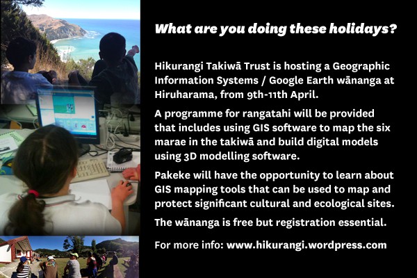
Hikurangi Takiwā Trust is pleased to invite whānau members affiliated to Te Aitanga-a-Mate, Te Aowera and Te Whānau-a-Rākairoa to a GIS/GoogleMaps wānanga to be held 9-12 April at Hiruharama Pa.
Rangatahi are especially encouraged to attend as there will be a special programme for teenagers and tamariki focused on creating GIS maps and 3D models for the six pa in the takiwā.
The wānanga starts 9.30am 9 Apereira at Hiruharama and concludes early Sunday 12th April. Hiruharama Pa is WiFi equipped and necessary tools and resources will be uploaded to a website for prior access and downloading to personal devices.
Sessions include:
- GIS in Conservation Reserves, a Ngati Porou case study
- My Marae, My Hapu, My Iwi: Using Google Maps in a Marae kind of way
- Geography & Placenames: the Ngai Tahu Project
- GIS for monitoring hapū wellbeing
- Site Visit: Kahuitara or Makatote – setting hinaki
- Hikurangi sunrise haerenga including drone filming of the maunga
Whanau will have the opportunity to work in small groups focused on different mapping kaupapa. There will also be an opportunity for those who wish to find out about local manuka oil production and plans for a nursery to participate in a workshop on this kaupapa.
There is no cost for the wānanga but numbers are limited so registration by 3 April is essential. Accommodation is available at Hiruharama Pa. Any koha/kai appreciated – ma tau rourou, ma taku rourou, ka ora ai te iwi.
Online registration is essential – sign up here: www.earthoutreach.org.nz
For more information visit the wananga website or contact: Pia Pohatu – pia@uritukuiho.org.nz


